Introduction
Scala2 is Marport’s advanced trawl monitoring system that collects, processes, stores and displays data sent from multiple sensors, sounders and other connected devices. It gives you full control over the fishing operations.
In order to suit the working conditions, gear and sensor data type available, this monitoring system offers unparalleled flexibility and is easily configurable.
Scala2 is the evolution of Scala. It supports Marport's new Pro range of sensors, the Door Explorer and Trident, as well as the Dock charger.
You can benefit from several enhancements:
- A Virtual Charger Room has been added to be used with the new Dock product.
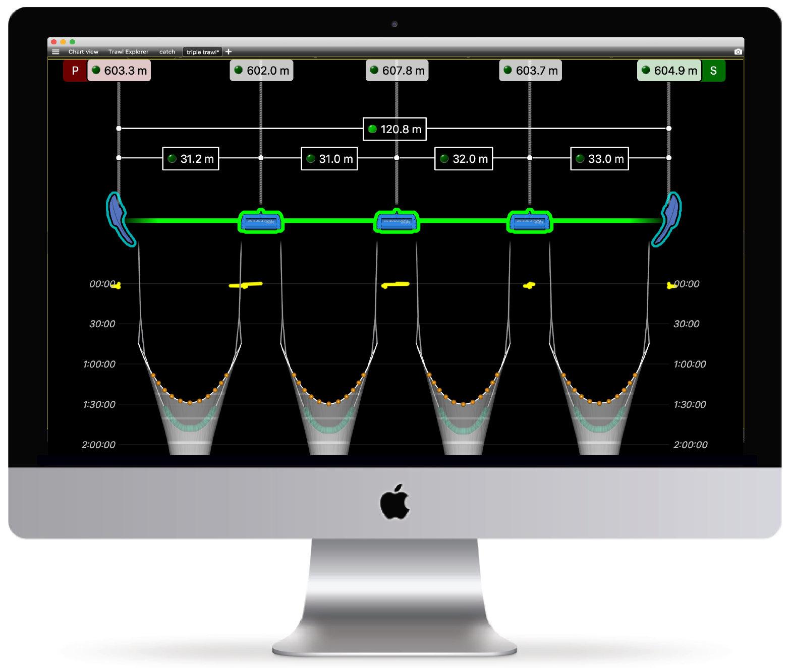
- A new multitrawl view of single, twin, triple, quad and penta trawls with doors and clump alignment, warp length and echogram display.
- Access all the customization options from a dedicated panel.
- Display vertical and horizontal echograms in order to be compliant with standard Explorer sensors and Seine Explorer sensors. This will give you a realistic display when the seine sensor pings sideways inside the seine.
- Display up to 6 spectrum analyzers to fully monitor the hydrophones' performance.
- Export a text file of the configuration of the receiver directly from Scala2.
- Easily play back historical data from A1 and A2S sensors. Data from A2S sensors can be imported and played back in high resolution.
- Add event markers in live time, then find them back when replaying data on ScalaReplay2.
You will also find the usual features from the first version of Scala:
- Display several simultaneous echogram presentations on a single page.
- Use drag and drop possibilities to customize your page layout.
- Choose from existing gauges, histograms or 3D views or create your own layout with any number of sensors displayable on screen.
- Adjust windows and graphs according to your needs.
- Compare data from equivalent sensors using multiple history plots.
Scala2 is optimized to interface with other marine equipment:
- It incorporates 3D simulation with bathymetry using a simple GPS data connection.
- It has a range of standard data inputs and outputs.