Displaying the Chart View
You can display the location and trajectory of the trawl behind the vessel if you receive GPS data and have door positioning sensors.
Before you begin
- You must be in Customize mode to do this task.
You must have:
- Incoming GPS data and heading data.
- Spread or Slant Range sensors with bearing measurement
- Warp lengths or Slant Range sensors giving distance to vessel
Procedure
-
From the lower part of the control panels, click
Customize.
The Customize panel appears.
-
Click + drag Chart to the page.
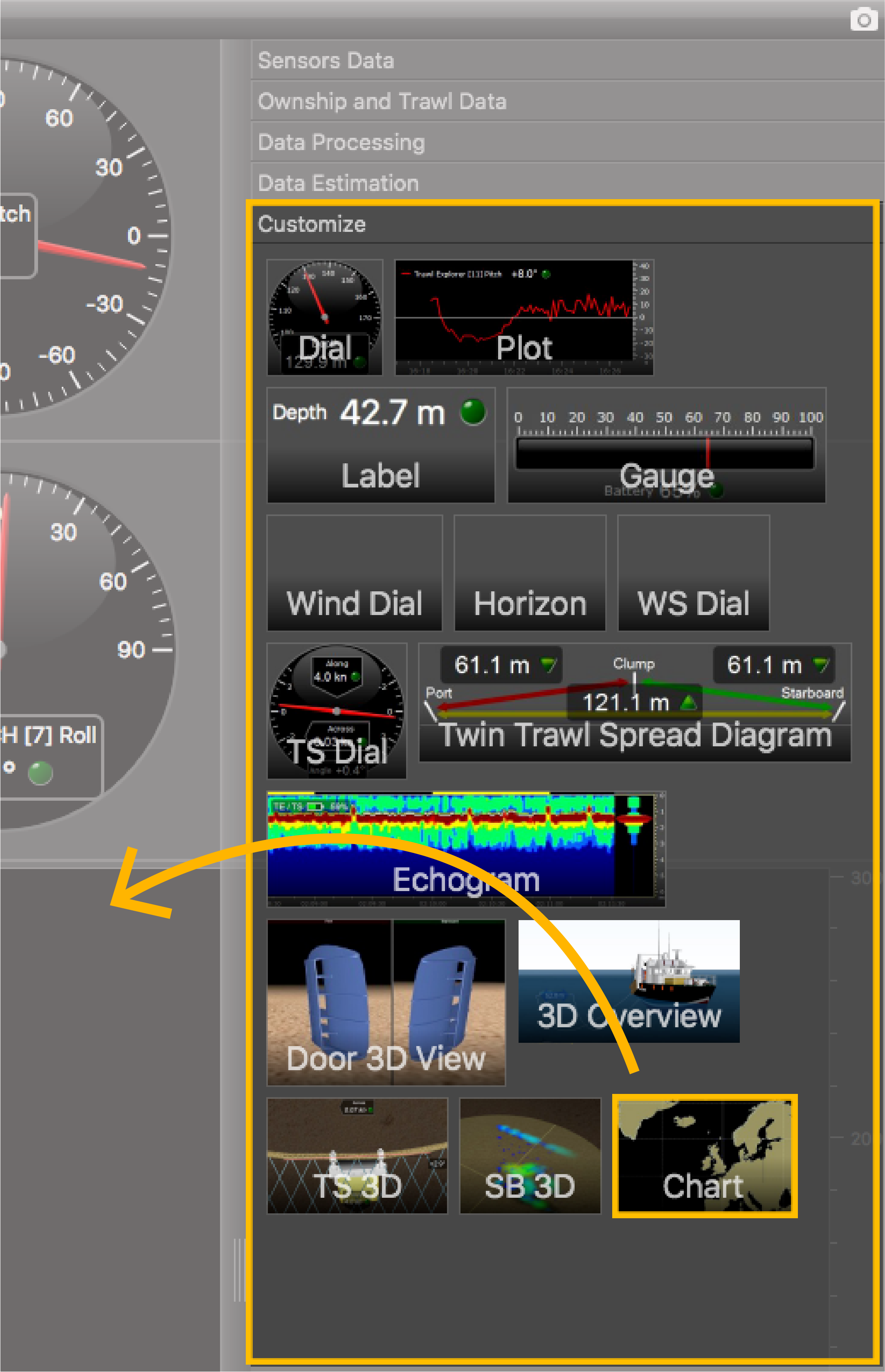
-
Drop it in a yellow area.
The chart view is displayed. The blue trail is the heading of the vessel, red trail is the port door and green trail is the starboard door.
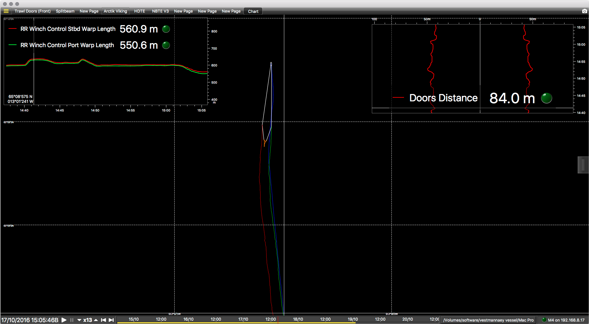
- If the view looks empty it might be because the view is not centered on the vessel. Right-click the view and click Center on Ownship or Center on Ownship and Trawl.
What to do next
 > Customize again.